Categories
Trail
Image
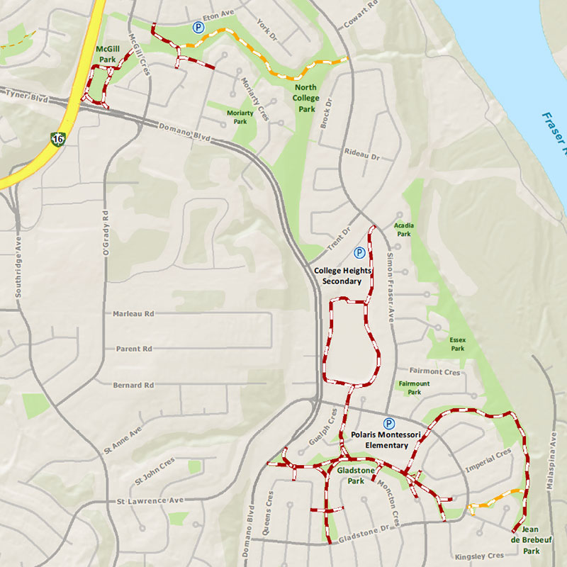
DISTANCE: 6.4 kilometres
ELEVATION: Relatively flat with less than 10 metres of elevation change.
TRAIL TYPE: Paved and dirt
AMENITIES:
- Playgrounds in Fairmont, Gladstone, North College, and Jean de Brebeuf Parks.
- Ball diamonds, outdoor ice rinks, and parks along the trail route.
COMMON ENTRY POINTS
- Multiple access points in College Heights.
- North College Park entry points include Eton Avenue, Monahan Crescent, Moriarty Crescent, and Simon Fraser Avenue.
Learn more about local trails
You can use third-party websites such as Alltrails.com to explore trails.
Contact information
Phone: 311 (or 250-561-7600 outside city limits)
Email: 311@princegeorge.ca
Need to report a problem? Submit a service request online.